Columbia River Gorge
Eighty miles of waterfall-lined basalt canyon carved by catastrophic floods
- Best Time to Visit: April–October (waterfalls peak with spring snowmelt)
- Distance: 30 miles east of Portland (45 minutes via I-84)
- Recommended Vehicle: Charter Coach or Mini Coach
Columbia River Gorge, Oregon / Washington
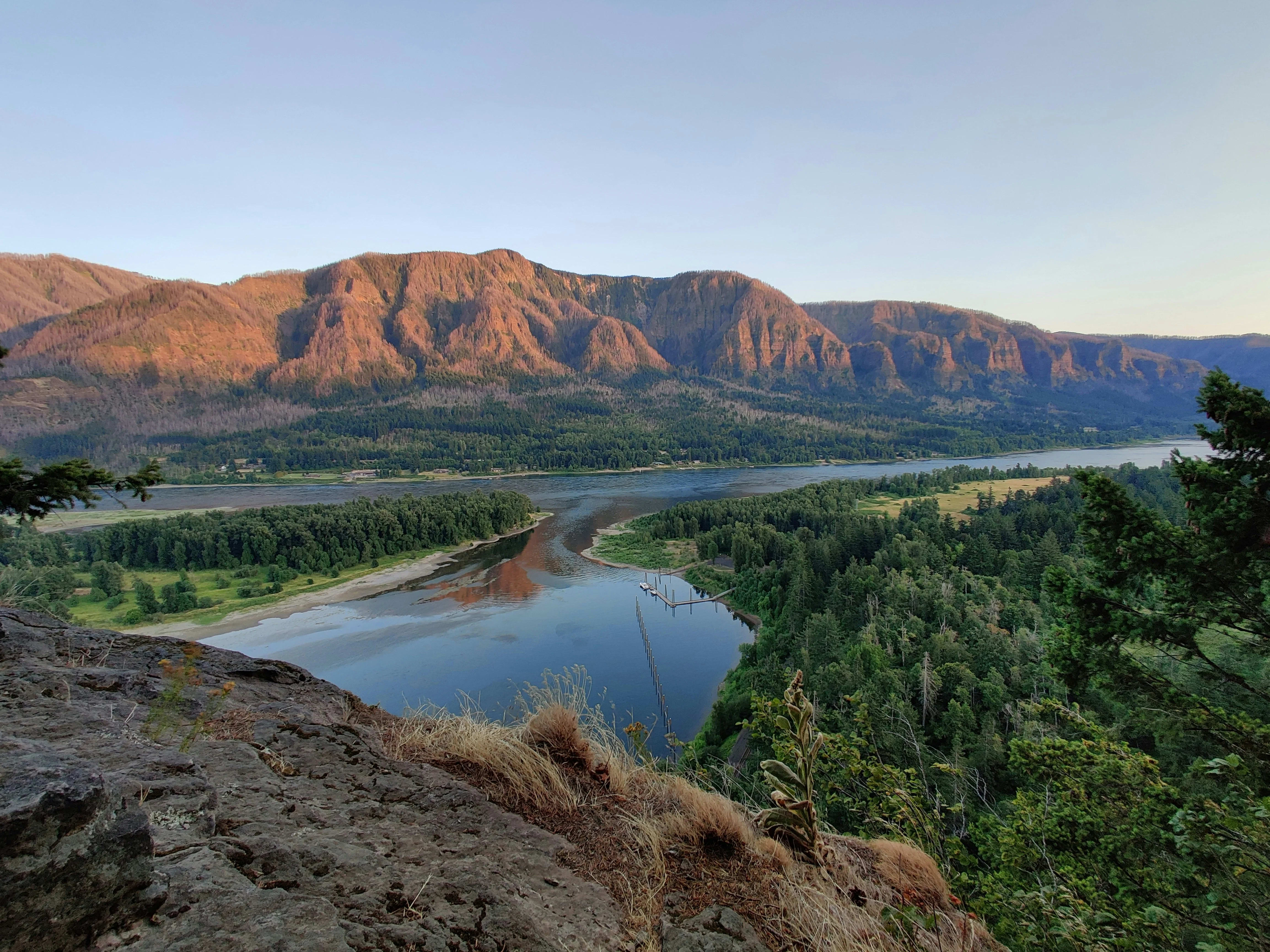
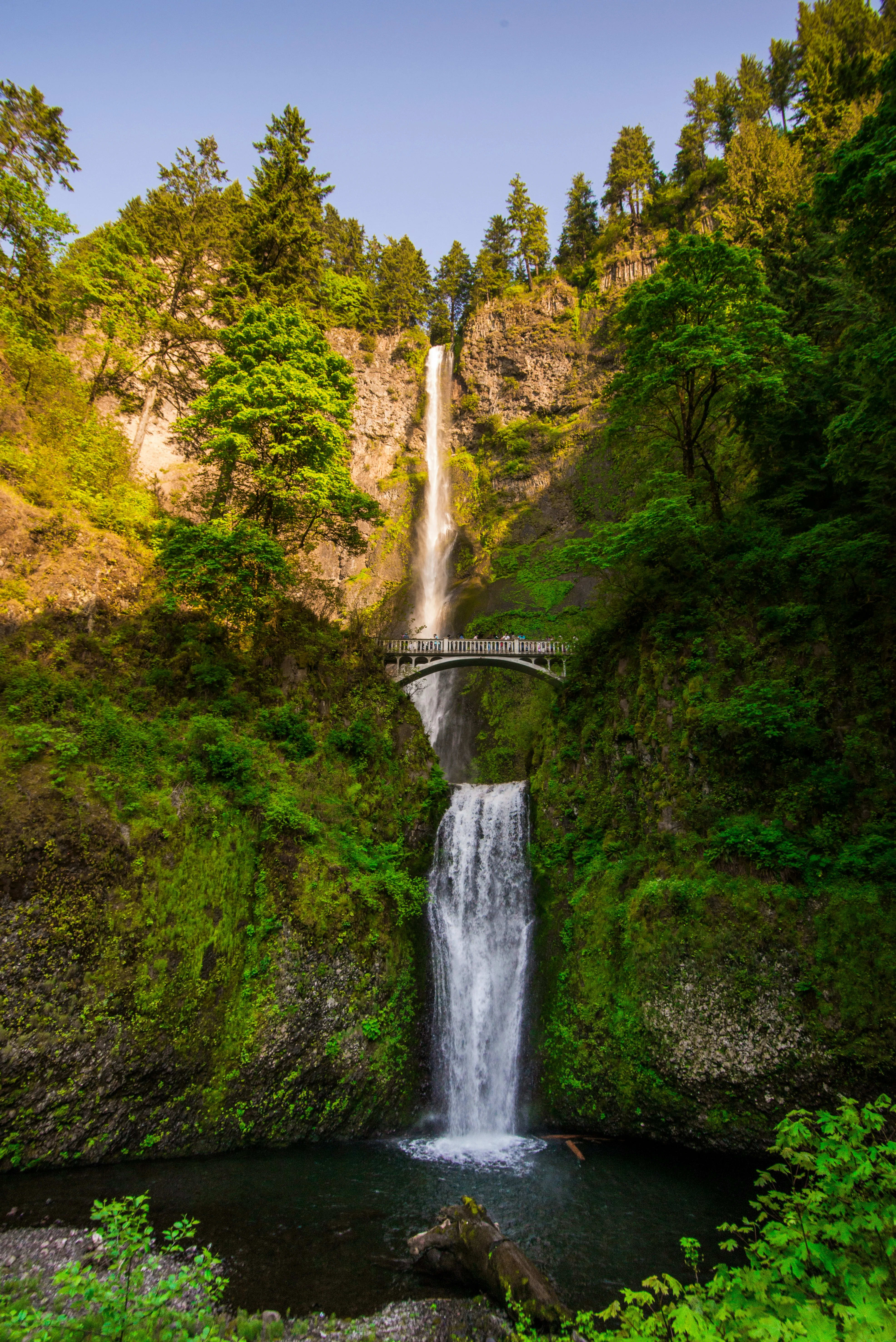
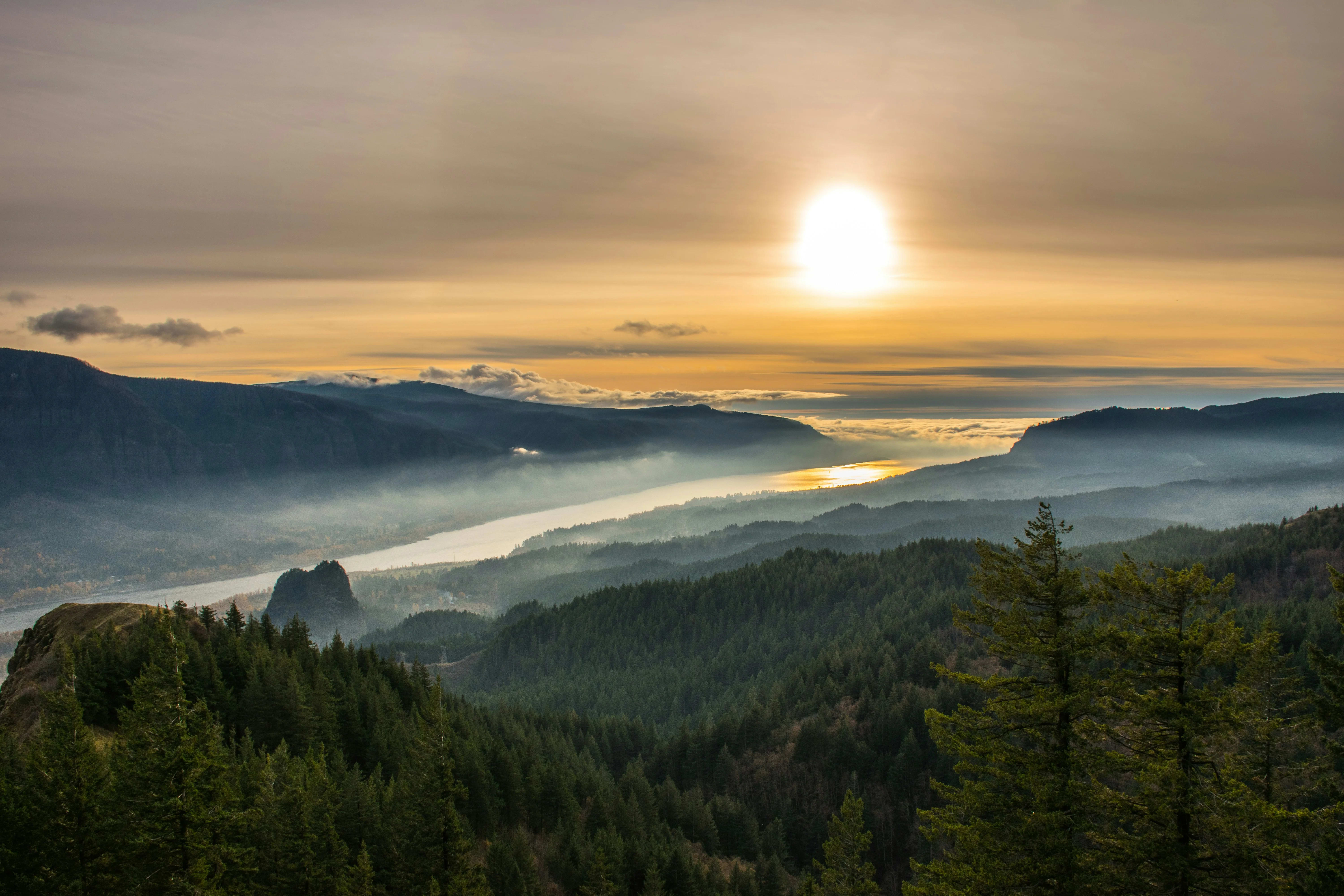
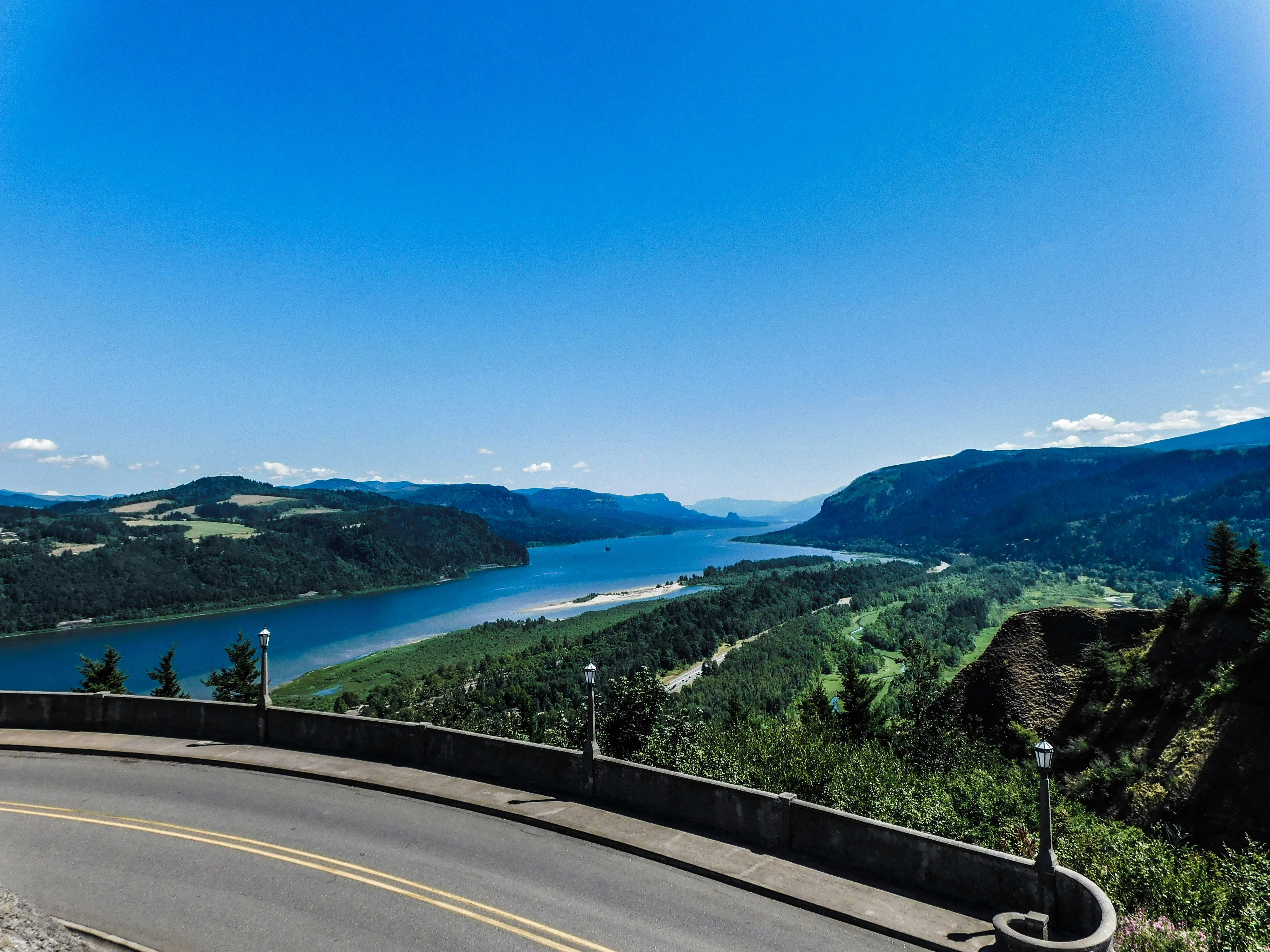
The Columbia River Gorge was carved during the Missoula Floods - a series of catastrophic ice-age floods between 15,000 and 12,000 years ago that repeatedly discharged the equivalent of 10 times the combined flow of all rivers on earth. The result is an 80-mile corridor of vertical basalt walls, hanging valleys, and over 90 named waterfalls on the Oregon side alone. Multnomah Falls - two tiers dropping a combined 620 feet - is Oregon's most visited attraction, with over 2 million visitors annually. The Historic Columbia River Highway, completed in 1922, was America's first scenic roadway, engineered with aesthetics as a primary consideration; the Vista House at Crown Point, a rotunda perched above a 730-foot cliff, is one of the most photographed buildings in Oregon. The gorge functions as a wind tunnel between the wet western Cascades and the dry eastern plateau, producing reliable strong winds at Hood River that have made it the windsurfing and kiteboarding capital of the world. The Washington side (SR-14) offers an often-overlooked perspective with Beacon Rock (second-largest monolith in North America), Cape Horn cliffs, and significantly fewer crowds.
Why Columbia River Gorge
Multnomah Falls
Oregon's most visited attraction - 620 feet of two-tier waterfall with a stone bridge spanning the lower tier.
Crown Point Vista House
1916 rotunda perched on a 730-foot cliff - one of Oregon's most photographed architectural landmarks.
Historic Columbia River Hwy
America's first scenic highway (1922) - curves through waterfall corridor with masonry bridges and stonework tunnels.
Beacon Rock (WA Side)
Second-largest monolith in North America - a 1-mile trail with 54 switchbacks to the summit.
Hood River Wind Sports
Reliable gorge winds make Hood River the windsurfing and kiteboarding capital of the western hemisphere.
Waterfall Corridor Hike
Walk between Latourell, Bridal Veil, and Multnomah Falls on the Historic Highway Trail - 5 miles one way.
Sample 2-Day Itinerary
Suggested stops and timing — customizable to your group's pace and interests.
Day 1 — Portland to Gorge Waterfalls
Day 1 — Portland to Gorge Waterfalls
Take I-84 east from Portland to the Corbett exit for Historic Highway 30. Drive the waterfall corridor: Latourell Falls, Bridal Veil, Wahkeena, Multnomah. Walk the Multnomah-Wahkeena loop. Continue to Vista House at Crown Point.
- Latourell Falls
- Wahkeena Falls
- Multnomah Falls
- Crown Point Vista House
Day 2 — Hood River & Washington Side
Day 2 — Hood River & Washington Side
Drive to Hood River for the Saturday Farmers Market (seasonal). Windsurfing watching at the Event Site. Return west on SR-14 along the Washington side: Beacon Rock, Cape Horn overlook, and Skamania Lodge.
- Hood River waterfront
- Beacon Rock State Park
- Cape Horn viewpoint
- Skamania Lodge view
The right vehicle for Columbia River Gorge
I-84 east and the Historic Highway both accommodate coaches. The Multnomah Falls parking area has designated coach parking. For the narrower Historic Highway (30), a mini coach is more comfortable.

Charter Coaches
Premium full-size coaches with generous legroom, ample luggage storage, and smooth highway performance for large groups.

Mini Coaches
Mid-size coaches that balance capacity with maneuverability — ideal for wine tours, day trips, and corporate outings.
Columbia River Gorge Gallery
Also Explore Nearby


Plan your Columbia River Gorge group charter today
Our team knows Columbia River Gorge inside out — from parking logistics to seasonal tips. Tell us your group size and dates and we'll design the perfect itinerary.
Request a Charter Quote