- Best Time to Visit: March–May; September–November (least fog, dry roads)
- Distance: 2.5 hours south of San Francisco (Monterey as the northern gateway)
- Recommended Vehicle: Mini Coach or Sprinter Van
Big Sur, California
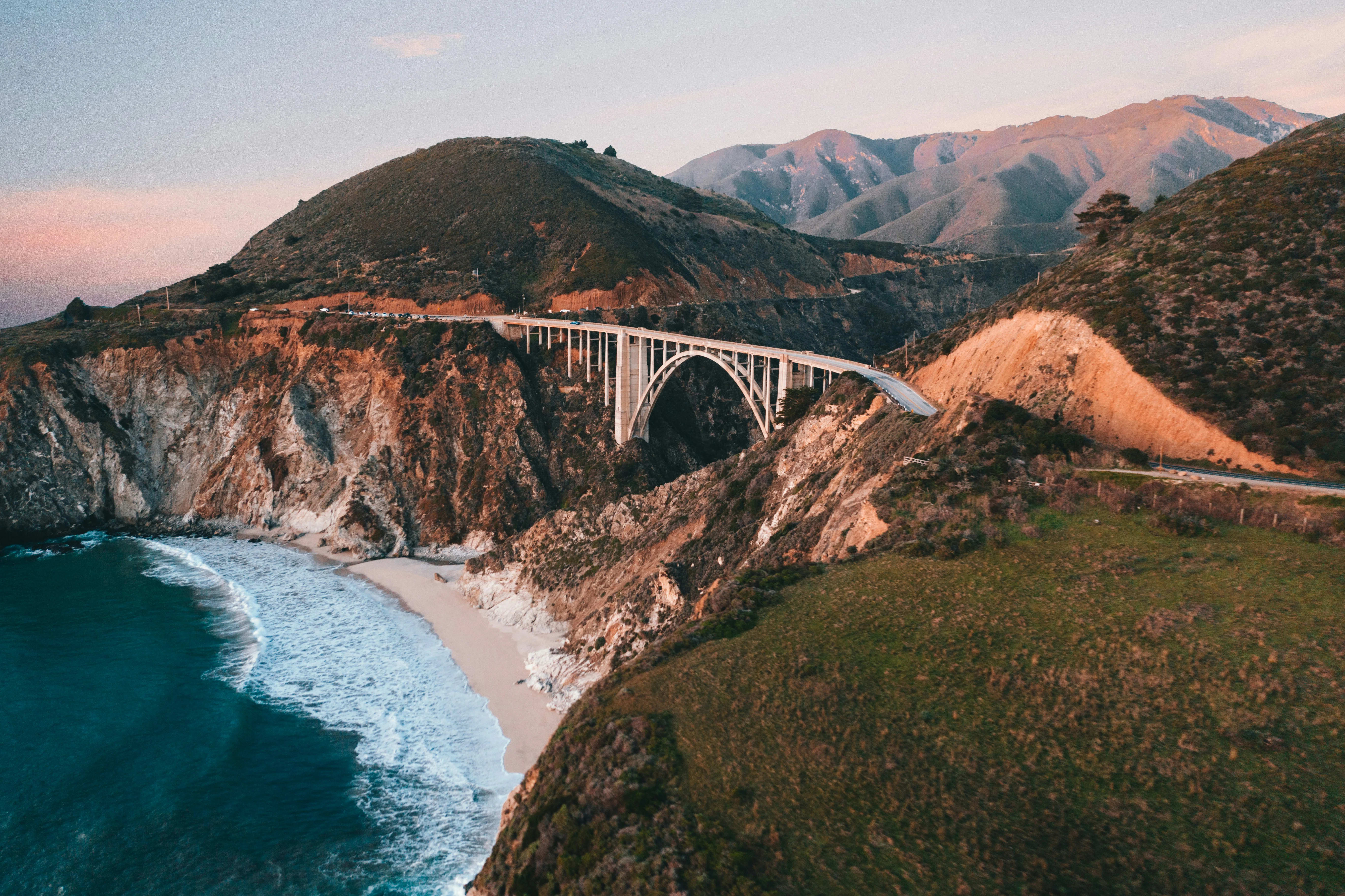
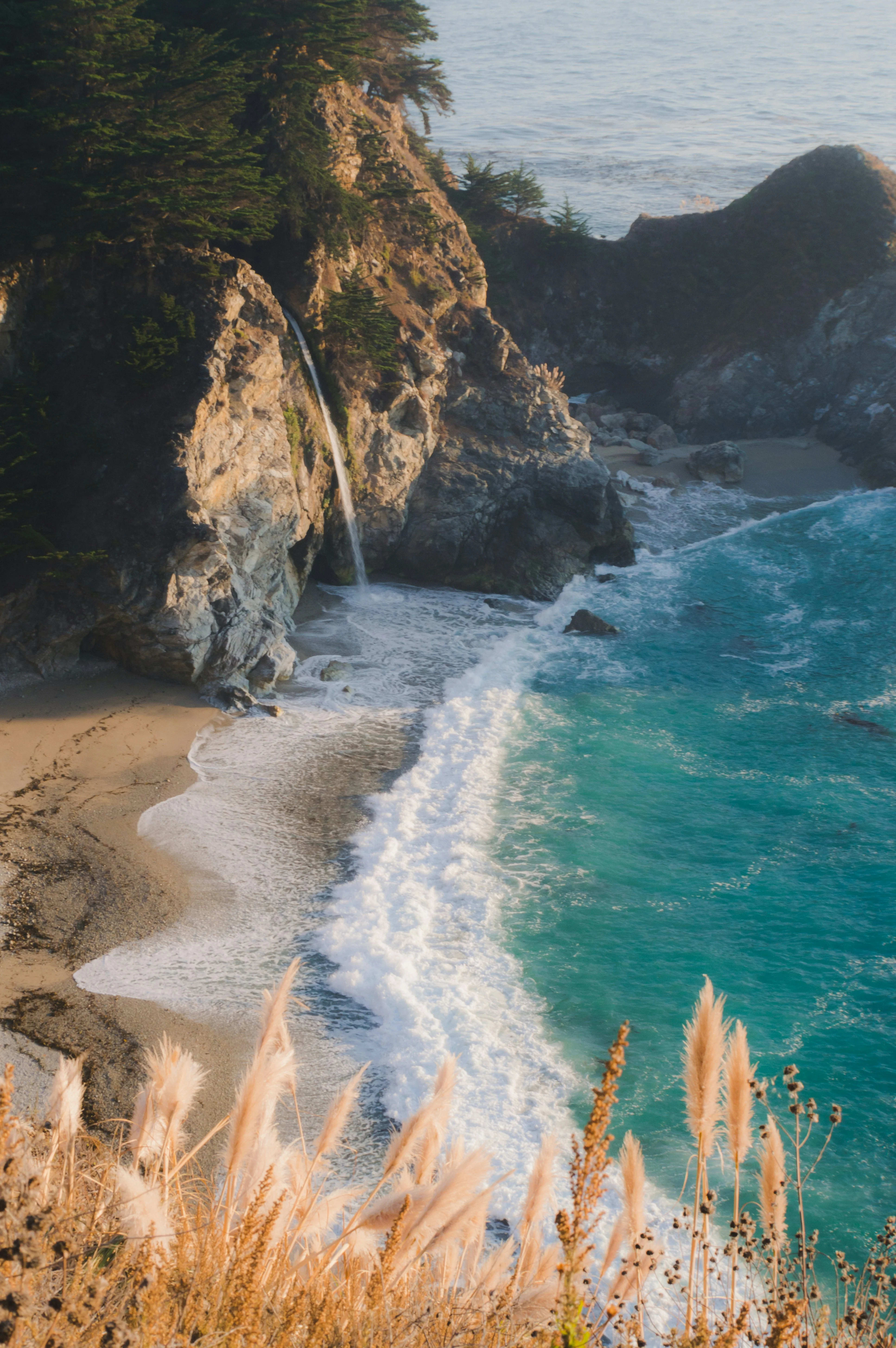
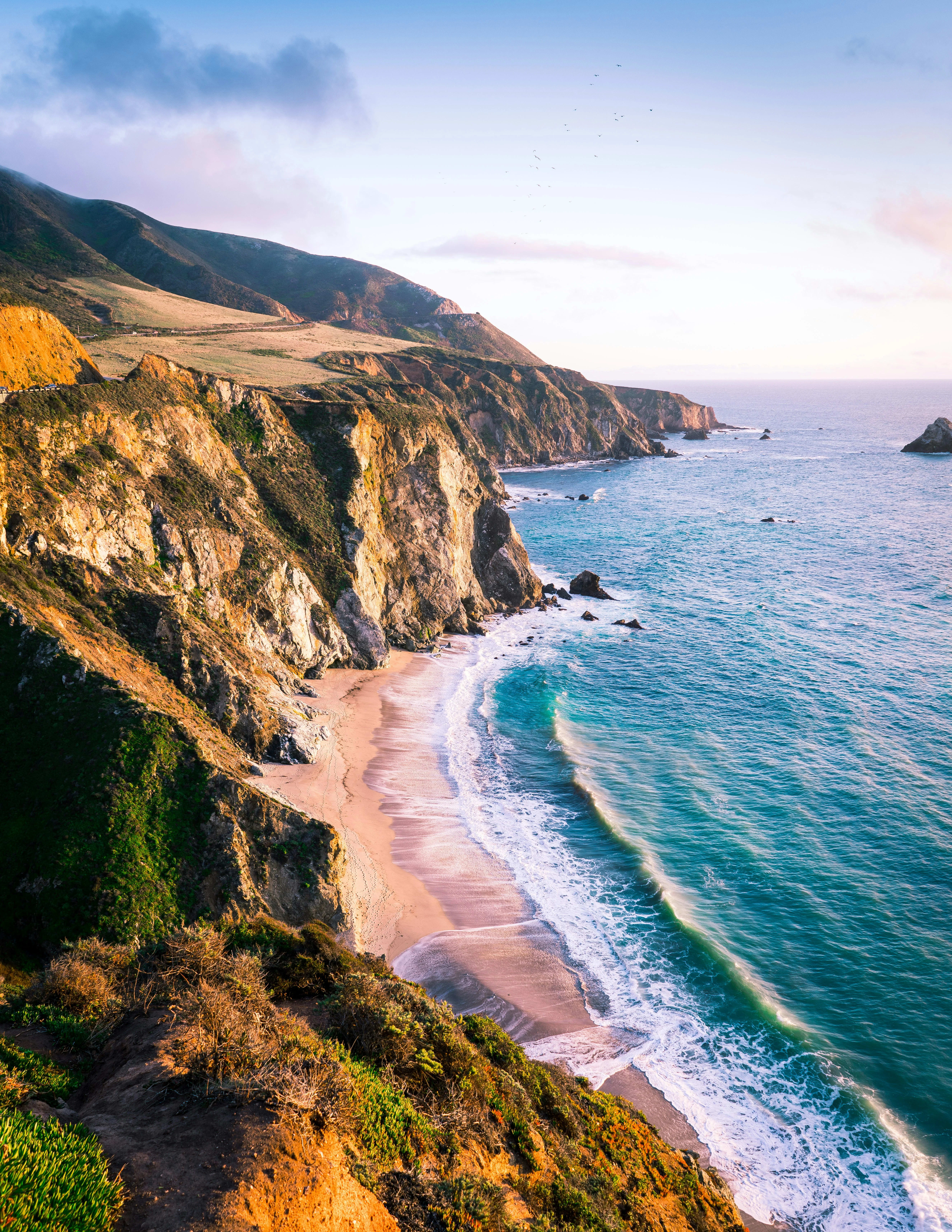
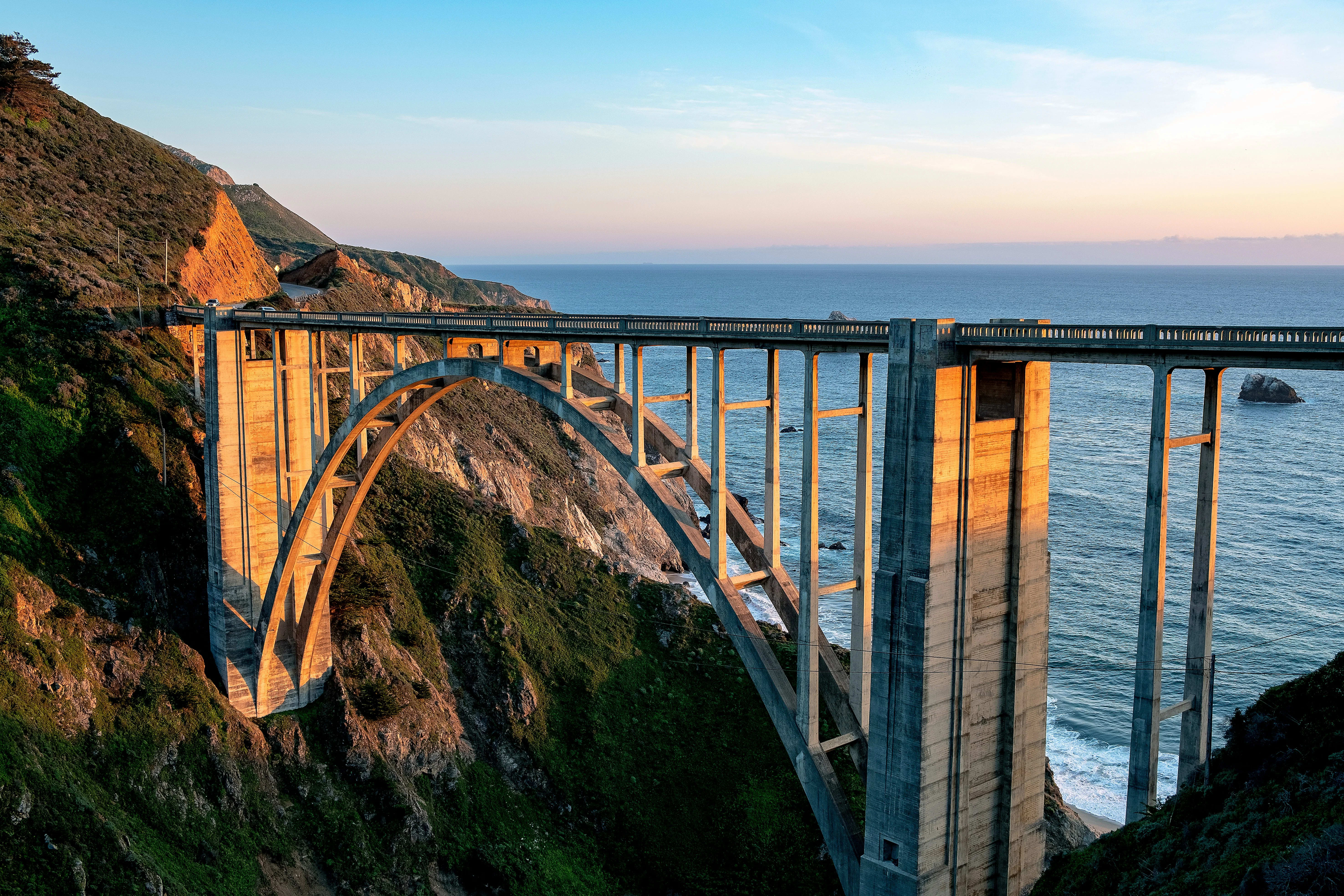
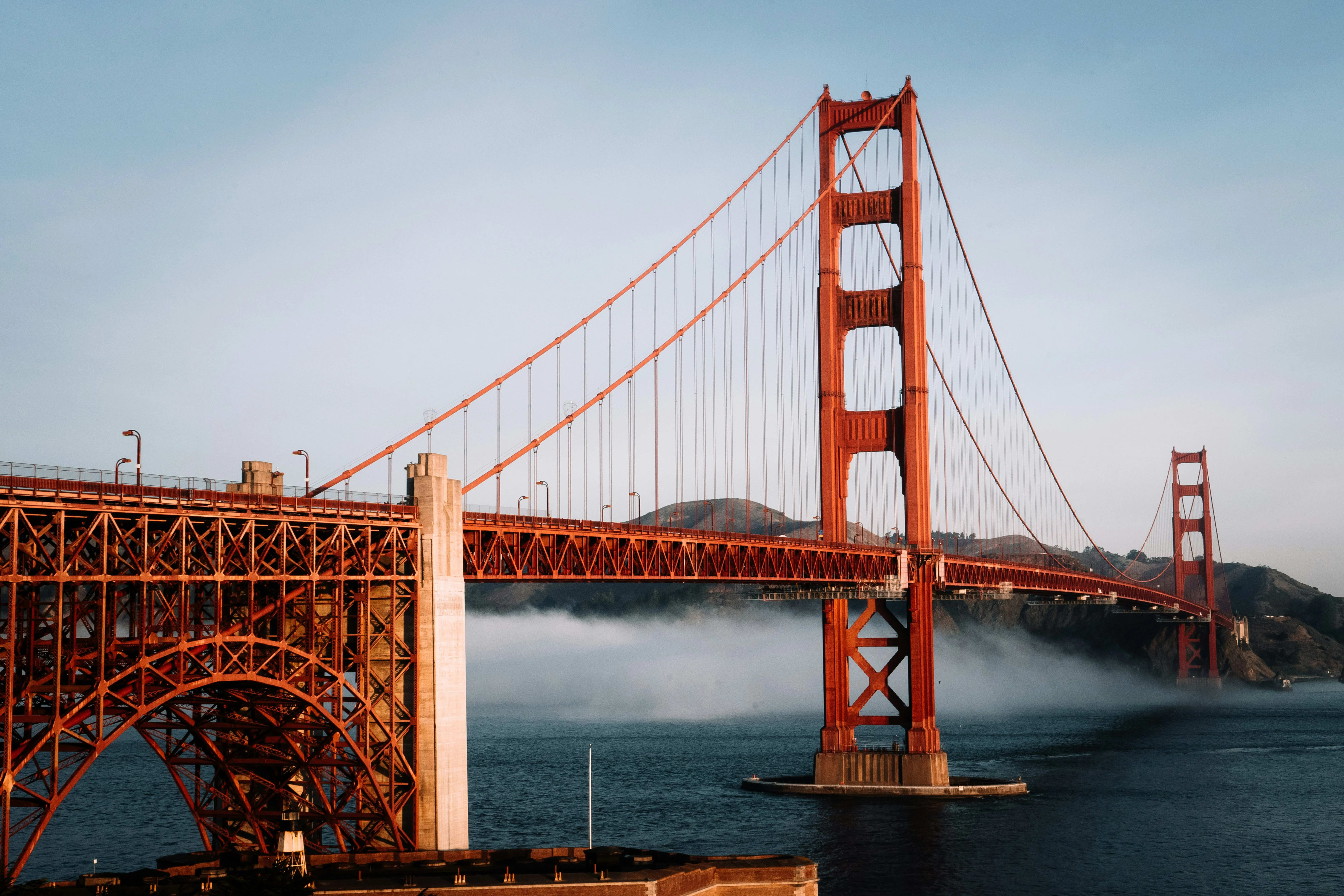
Big Sur is defined by its inaccessibility no railroad ever reached it, no significant flatland exists for development, and the single road (California Highway 1) was completed only in 1937, cutting through terrain so severe that its construction required seven years and cost the 1930s equivalent of $3 million per mile. The result is one of the longest stretches of undeveloped coast in the lower 48 states. Bixby Creek Bridge, one of the longest single-arch concrete bridges in the world when completed in 1932, is photographed from the turnout on its north side by an estimated million visitors per year. Point Sur State Historic Park preserves a volcanic rock with a 19th-century lighthouse accessible by guided walk only. McWay Falls at Julia Pfeiffer Burns State Park drops 80 feet directly onto a beach cove one of only a few tidefall waterfalls in California. The Esalen Institute hot springs, perched on a cliff above the ocean, are open to the public from 1–3 a.m. only (reservations required). Highway 1 through Big Sur has been repeatedly closed by landslides and erosion the Pfeiffer Canyon Bridge was replaced after a 2017 slide, and the route's fragility is part of its character.
Why Big Sur
Bixby Creek Bridge
714-foot single-arch span above a Pacific canyon the most photographed bridge on the California coast.
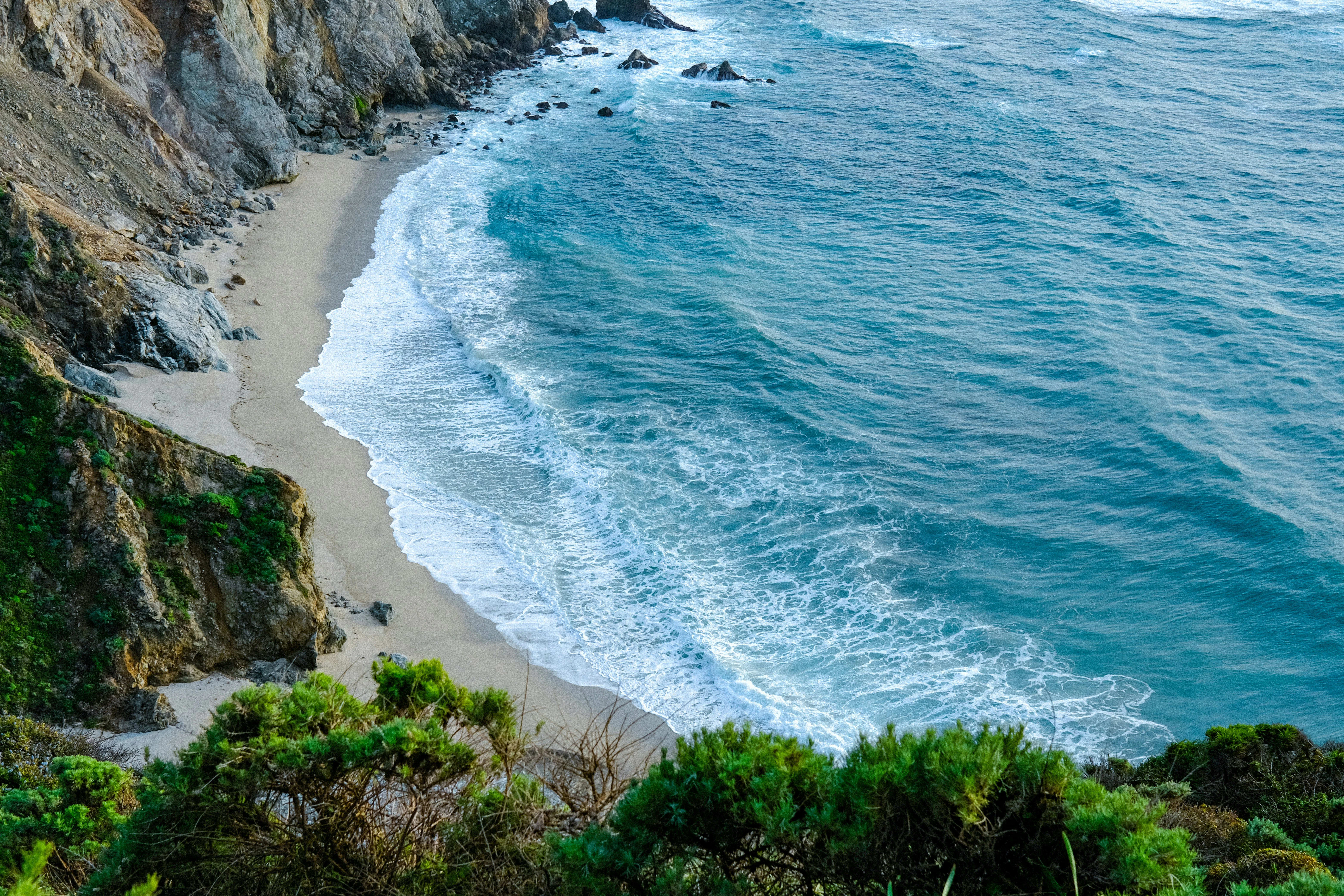
McWay Falls (Tidefall)
80-foot waterfall dropping directly onto a sandy cove one of the few tideland falls in California.
Point Sur Lighthouse
Volunteer-led tours of an 1889 lighthouse on a volcanic headland rock accessible only on guided walks.
Ventana Wilderness Hikes
Backcountry Santa Lucia redwood canyons and ridgeline hikes above the coast some routes solitary.
California Condor Viewing
Recovering condor population regularly visible soaring over the Big Sur ridgeline a conservation success story.
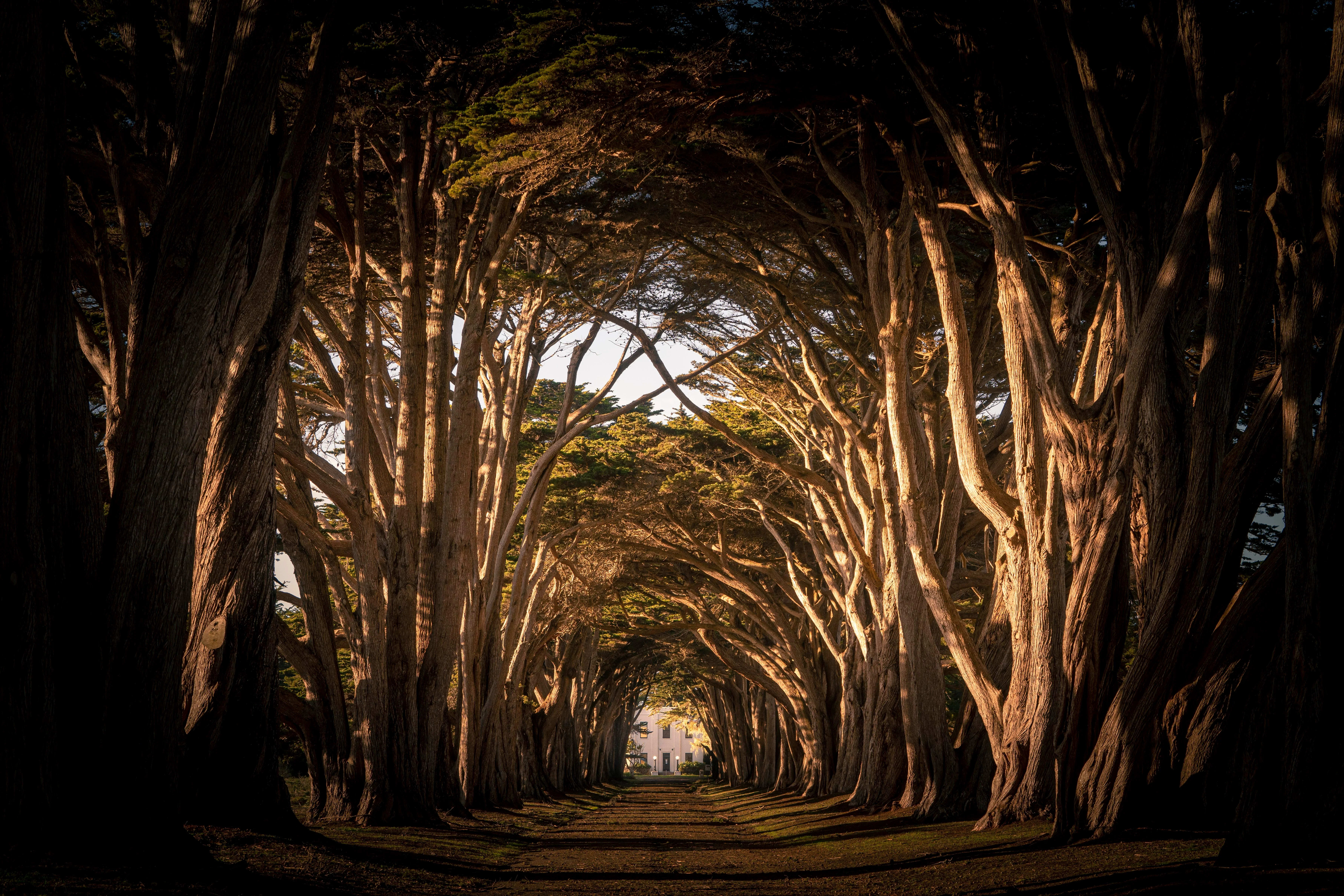
Pfeiffer Big Sur State Park
Valley-floor redwood forest camping and hiking rare Santa Lucia fir and big-cone spruce among resident trees.
Sample 2-Day Itinerary
Suggested stops and timing — customizable to your group's pace and interests.
Day 1 — Monterey to Big Sur South
Day 1 — Monterey to Big Sur South
Depart Monterey south on CA-1. Stop at Point Lobos State Natural Reserve for the morning. Continue south past Bixby Bridge. Stop at Big Sur Station for trail maps. Afternoon: McWay Falls at Julia Pfeiffer Burns. Overnight Pfeiffer Big Sur.
- Point Lobos Reserve
- Bixby Creek Bridge
- Pfeiffer Big Sur State Park
- McWay Falls
Day 2 — Deep Big Sur Jade Cove to Cambria
Day 2 — Deep Big Sur Jade Cove to Cambria
Drive south to Jade Cove beach (beach cobbles include California's nephrite jade). Continue to San Simeon (Hearst Castle tour optional). End in Cambria. Return north via CA-1 or inland US-101.
- Sand Dollar Beach
- Jade Cove
- San Simeon Hearst Castle
- Cambria village
The right vehicle for Big Sur
Highway 1 through Big Sur is a single-lane-each-direction winding coastal road. Smaller vehicles handle the curves and pullouts more safely, and many key viewpoints have limited parking. Mini coach maximum recommended.

Sprinter Vans
Executive Mercedes Sprinters for smaller groups — nimble in city traffic, easy to park, and comfortable on scenic routes.

Mini Coaches
Mid-size coaches that balance capacity with maneuverability — ideal for wine tours, day trips, and corporate outings.
Big Sur Gallery
Also Explore Nearby
Plan your Big Sur group charter today
Our team knows Big Sur inside out — from parking logistics to seasonal tips. Tell us your group size and dates and we'll design the perfect itinerary.
Request a Charter Quote