Point Reyes
A peninsula in geological rebellion, earthquake trails, elk, and oysters
- Best Time to Visit: March-May (wildflowers); December-April (gray whale migration)
- Distance: 1.5 hours north of San Francisco via US-101 and Sir Francis Drake Blvd
- Recommended Vehicle: Mini Coach or Sprinter Van
Point Reyes, California
Point Reyes National Seashore is one of the most ecologically diverse national parks in the US, a 71,000-acre peninsula that combines coastal bluffs, forested ridges, meadow uplands, and esteros tidal lagoons that are among the most productive marine environments on the Pacific Coast. The park sits on the Pacific Plate, separated from the North American Plate by the San Andreas Fault, which runs directly through it. The 1906 earthquake moved Point Reyes 16 feet in 90 seconds; a fence post straddling the fault is visible along the Earthquake Trail at the Bear Valley Visitor Center. Drake's Bay, on the sheltered south side of the point, is the location where Sir Francis Drake likely careened his Golden Hinde for repair in 1579 the oldest English presence in North America. Tule elk were nearly hunted to extinction by 1870; the Point Reyes herd, reintroduced in 1978, has grown to over 500 animals and can be seen from Tomales Point at the park's north end. Drakes Bay Oyster Company (operating under a changing permit system) and the small oyster farms of Tomales Bay to the east produce oysters in pristine cold water conditions that make Point Reyes one of the best places in California to eat fresh shellfish.
Why Point Reyes
Earthquake Trail
Walk the San Andreas Fault at Bear Valley a fence post offset 16 feet by the 1906 earthquake marks the exact line.
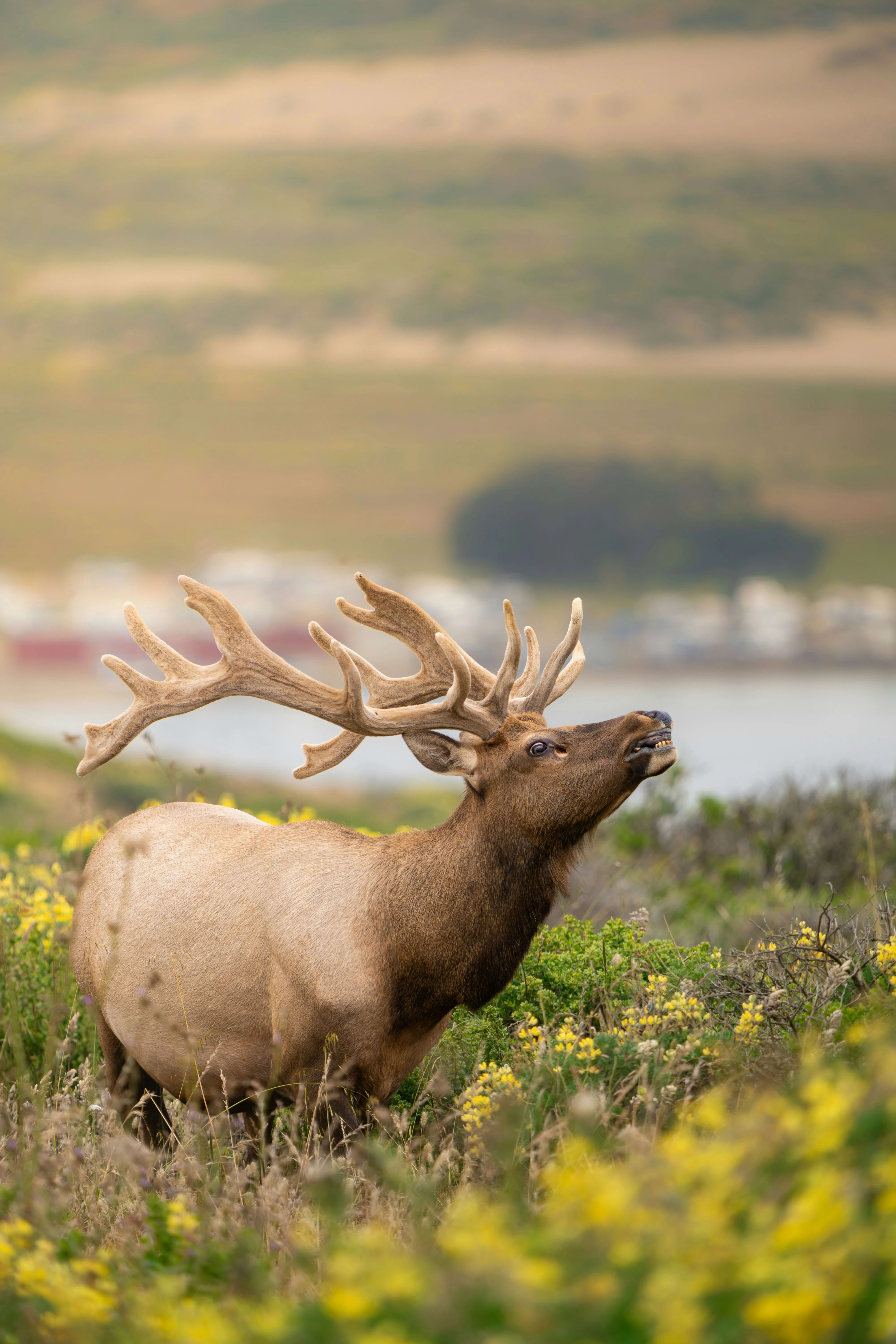
Tule Elk Herds
500+ tule elk reintroduced to Tomales Point in 1978 best viewing at dawn and dusk from park trails.
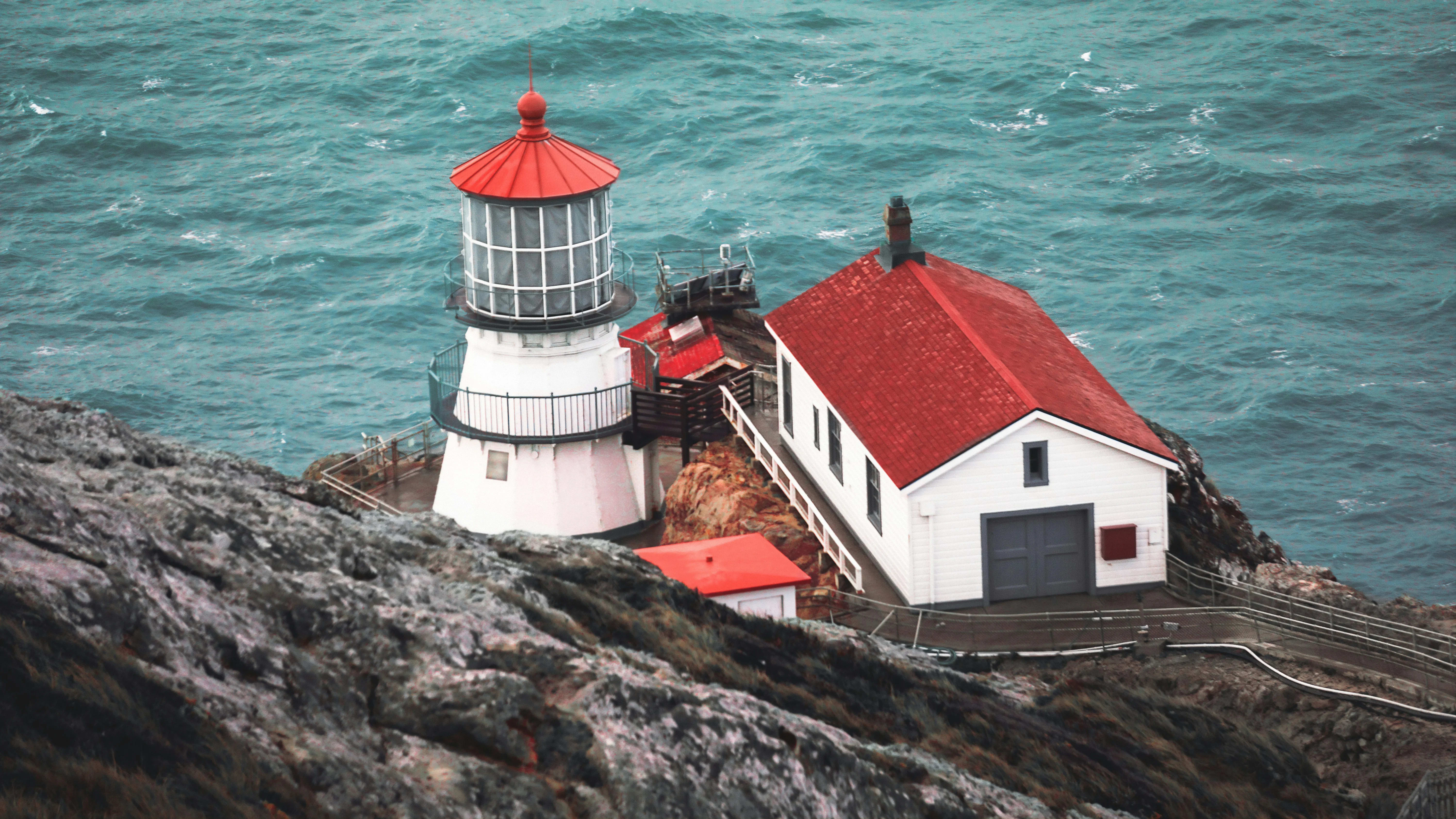
Point Reyes Lighthouse
1870 lighthouse at the foggy, windswept western tip of the peninsula California's most fog-shrouded point.
Tomales Bay Oysters
Hog Island Oyster Company and Tomales Bay Oyster Company sell direct from racks in pristine bay water.
Limantour Beach
Wide sand beach on the sheltered Drake's Bay side calmer than the outer coast and scenic year-round.
Kehoe Beach Sea Caves
Pocket beach with sea caves and dramatic rock formations on the park's isolated north coast.
Sample 1-Day Itinerary
Suggested stops and timing — customizable to your group's pace and interests.
Day 1 — San Francisco to Point Reyes
Day 1 — San Francisco to Point Reyes
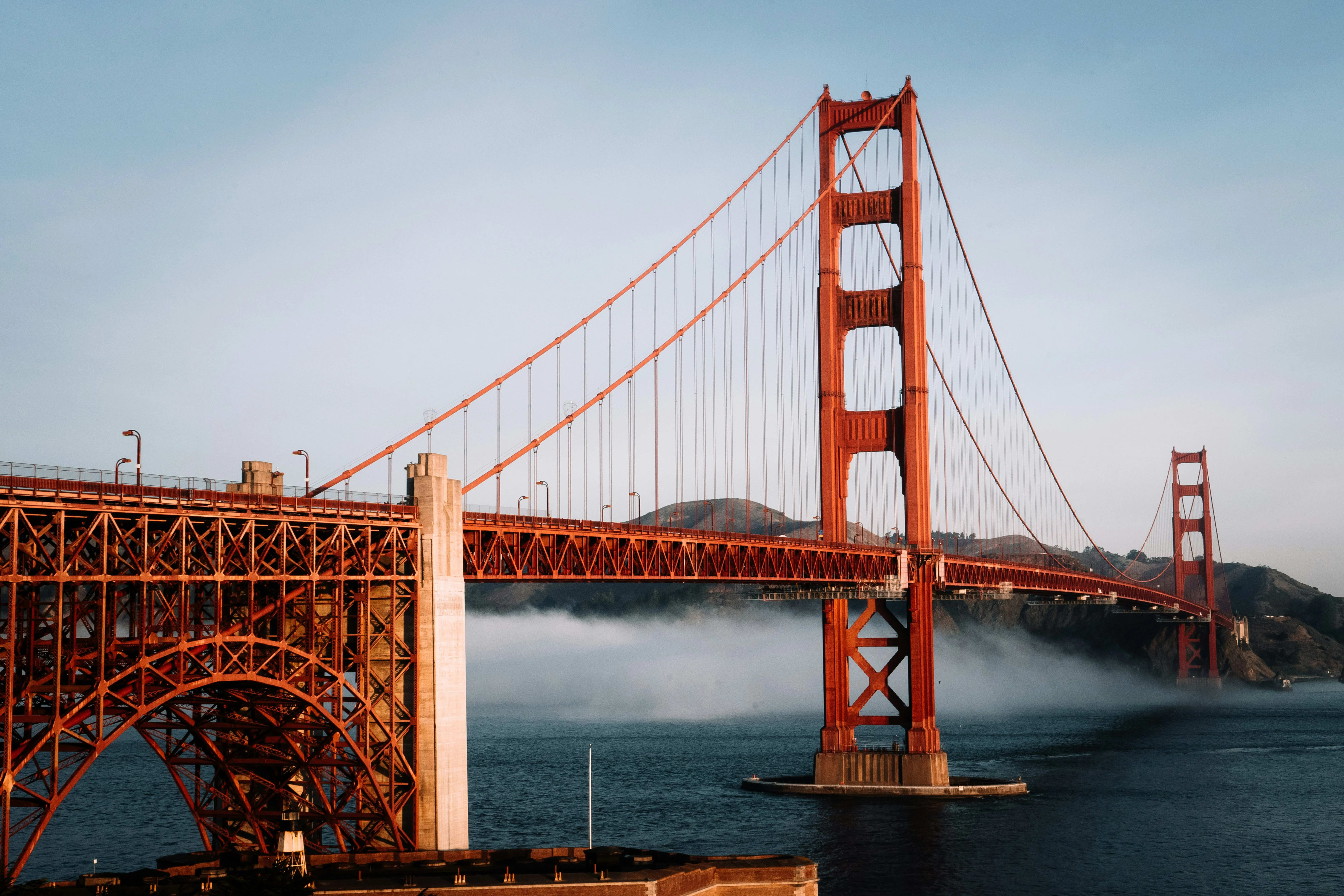
Drive US-101 north across the Golden Gate, west on Sir Francis Drake Blvd (1.5 hours). Bear Valley Visitor Center and Earthquake Trail. Afternoon: drive Sir Francis Drake Blvd to Point Reyes Lighthouse (when open). Stop at Tomales Bay Oyster Company.
- Bear Valley Visitor Center (Earthquake Trail)
- Drake's Beach
- Point Reyes Lighthouse
- Tomales Bay Oyster Company
The right vehicle for Point Reyes
Sir Francis Drake Boulevard is a winding narrow road. Smaller vehicles handle the approach more comfortably and park at trailheads without difficulty.

Sprinter Vans
Executive Mercedes Sprinters for smaller groups — nimble in city traffic, easy to park, and comfortable on scenic routes.

Mini Coaches
Mid-size coaches that balance capacity with maneuverability — ideal for wine tours, day trips, and corporate outings.
Point Reyes Gallery
Also Explore Nearby
Plan your Point Reyes group charter today
Our team knows Point Reyes inside out — from parking logistics to seasonal tips. Tell us your group size and dates and we'll design the perfect itinerary.
Request a Charter Quote